Online Reporting for Biodiversity (ORB) Tool
Generate Biodiversity Reports for Alberta
The ABMI’s online reporting tool provides easy access to both land use and biodiversity information for Alberta.
What is the ORB tool?
The Online Reporting for Biodiversity (ORB) tool lets users select an area of interest and easily access user-friendly reports on land cover and biodiversity for Alberta.
What are some of the current and planned features of the ORB tool?
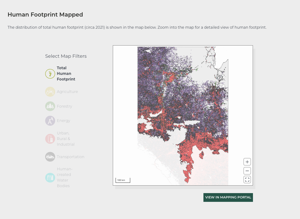
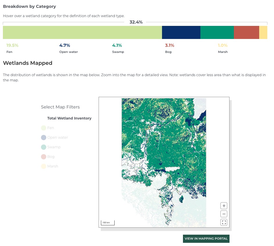
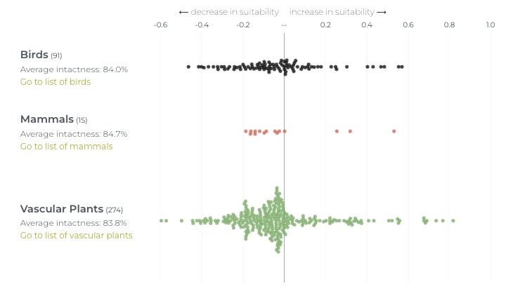
Key highlights of the ORB tool include its intuitive interface, tailored reports based on user-selected areas of interest, and its ability to present data in an easy-to-digest format. Reports consist of interactive graphs, colourful maps, species lists, and tables that display information covering human footprint, wetland area, biodiversity intactness (birds, mammals, and vascular plants), as well as other general information.
The tool will be regularly updated with new features and data to ensure its relevance and usefulness over time.
We anticipate that future updates to the tool will include:
- summaries for more indicators like linear density, interior native habitat, and intactness for other taxonomic groups;
- indicator selection;
- data and summarized results available for download;
- PDF export; and
- the addition of more areas of interest, such as the hydrologic unit code (watershed) boundaries.
The ABMI’s Online Reporting for Biodiversity tool provides easy access to both land use and biodiversity information for Alberta with a user-friendly interface.

Using the ORB Tool
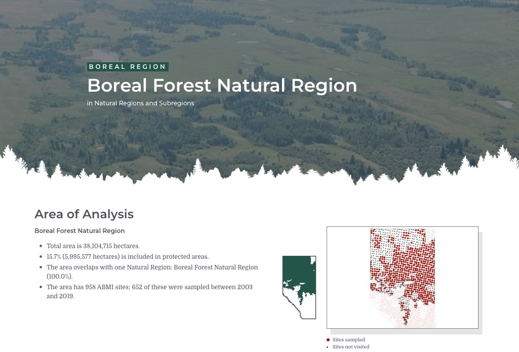
To generate a report, users simply select an area of interest from a menu – such as a natural region, land-use planning region, or county – and the tool instantly creates an online and interactive report that contains summarized land cover and biodiversity information for that region.
Watch a video tour demonstrating how to use the tool here.
Human Footprint
Users can view the extent of human footprint types in the area and how much the amount of human footprint in the area of interest has changed in the past two decades.


Wetlands
The ORB tool provides an overview of wetland classes in the area, based on the ABMI’s Wetland Inventory for Alberta.
Biodiversity Intactness
Reports include a summary of biodiversity intactness in a region – meaning the degree to which human footprint has affected habitat suitability for different species. Generated reports include an interactive map of overall intactness for the region, and a series of graphs that depict changes in habitat suitability by taxonomic group and by species.

Financial support for the development of the ORB tool generously provided by the Government of Alberta.
Explore our Online Reports
Reporting on the status of land cover and biodiversity in Alberta.
